NOAH Intelligence has developed dynamic flood modeling and flood simulation technologies to provide greater accuracy and scalability for property managers, real estate agencies, insurance companies, financial institutions and municipalities. The company is on a mission to help all property owners manage the reality of their flood risk using accurate data and achievable flood defense.
To make this possible, NOAH produces specialized flood models that reveal new and more accurate dimensions of property-level flood risk. NOAH then simulates future extreme weather events and gathers data on their impacts to a specific property. Finally, NOAH uses its data and insights to help clients execute flood defense measures.
The journey toward resilience and adaptation starts with understanding flood risk at a property-specific level. To fulfill its mission, NOAH plans to deliver over 12 million Flood Risk Scorecards to property owners in Canada – including scorecards for over 400,000 commercial and institutional buildings.
NOAH’s Flood Risk Methodology
The growing frequency, intensity, and widespread distribution of extreme weather events with flooding potential call for a new approach to identify and manage flood risks. To enhance climate resilience, we must better understand and implement mitigation strategies for these rising threats.
Although there are significant differences between regions, in general climate change is altering precipitation patterns by intensifying rainfall events and extending drought periods between them. Warmer air masses, energized by higher temperatures, concentrate atmospheric moisture into larger and more intense storms when the increasing frequency of appropriate atmospheric conditions allow. These storms can cause both localized flash floods and widespread regional flooding by delivering sufficient rainfall volume in a sufficiently short period of time to generate runoff flows that overwhelm municipal drainage system components, including storm sewer systems, overland flow pathways and roadway corridors. Consequently, traditional flood mapping, which tends to focus on identifying broad high-risk flood-prone areas typically associated with overbank flooding for watercourses that experience flows larger than their valley capacities or shoreline areas subject to wave uprush from large waterbodies, often overlooks localized zones with inadequate drainage systems that are now vulnerable to the increased runoff from these climate-altered precipitation patterns.
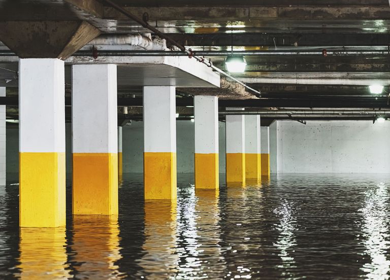
While NOAH’s capabilities extend to riverine and coastal flood risk, the company’s proprietary contributions to improved flood modeling target pluvial flood risk from inadequate drainage systems. Flooding influenced by inadequate urban drainage infrastructure needs as much attention as natural coastal and river-basin flood hazards. The presence of significant real estate assets clustered in dense urban and metropolitan areas that are disproportionately affected by this type of flooding prompted the need for alternative approaches to address this more specialized type of flood modeling and risk categorization.
By combining deep domain expertise in civil engineering with advanced innovations in hydraulic modeling, NOAH is deploying physically accurate simulations of municipal stormwater and sewershed assets. NOAH’s methodology includes the usage of traditional storm and sewer system profiles, combined with roadway corridor profiles and digital topography mapping. GIS databases, digital topography models, roadway network mapping and municipal asset management programs are all leveraged to build NOAH’s accurate digital replica of the hydraulically relevant infrastructure for surface and subsurface drainage flow.
Once created, NOAH’s hydraulic model is used to simulate the response of defined municipal areas serviced by a branching storm or combined sewer system. The output of NOAH’s approach allows for highly accurate modeling of virtual precipitation scenarios.
NOAH’s model is trained on rainfall scenarios including traditional or historical design storms, as well as variations reflecting climate change impacts. Variations impacting the model can be designed to involve simple percentage-based increases in storm intensity, along with simulations of extreme cloudbursts or catastrophic events.
Additionally, NOAH’s model can be calibrated against re-creations of historic storm events at any location. This can include re-creations of flood events from rain gauge recordings such as the ‘trailing thunderstorms’ experienced on July 16, 2024, in Toronto. The resulting runoff response can be visualized to assess relative flood risks and will generate detailed profiles for properties within the defined municipal area. This enables the creation of a “flood risk score” for each property and helps identify the scale of resiliency measures needed to mitigate potential flooding.
A key advantage of NOAH’s model is the ability to simulate system failures and identify weaknesses and tipping points that lead to flooding (experienced as runoff flows escaping the conveyance limits of the dual drainage system components) without causing real world damage. The model can also estimate when flooding surpasses tolerable levels, creating safety hazards and providing estimates of the monetary damages required for recovery.
NOAH’s data output is particularly valuable for creating detailed risk profiles for individual properties. These profiles can be considered by insurance providers in setting overland flood policy rates and help property owners understand their relative flood risks. Additionally, they can highlight potential hazards to occupants, enabling improved evacuation, preparedness and mitigation efforts.
NOAH’s approach is a highly reliable, tested process and utilizes proven software and technology with the subroutine systems required to accomplish physically accurate results. The approach allows for rapid generation of model databases virtually representing municipal drainage infrastructure as the model’s minor system where runoff flows are conveyed below ground. The addition of digital surface topography represented by DTM (digital terrain models), TIN (triangulated irregular networks) and other digital formats allows for a representation of surface features as a major system that generates, collects and conveys runoff once the conveyance capacity of the minor, below ground system is exceeded. NOAH’s dynamic approach represents a model that integrates 2D surface flow simulations with interacting sub-surface modeling, vastly enhancing location accuracy and extents where floodwater will accumulate.
Use Cases
NOAH’s model output is used to classify flood event hazards and assign damage ratings for various property types, resulting in NOAH’s Flood Scorecards for individual properties. The model is also used to support detailed flood risk assessments. Additionally, flood depth-velocity data or water depth banding shapefiles are integrated into an API layer, offering subscription-based access for flood insurance and finance providers, as well as for governments and organizations focused on climate risk and flood resilience. This data can support the validation of in-house hydraulic models for underwriting or serve as a resource for providers without in-house modeling capabilities. Other use cases include analyzing the hydraulic performance of sewershed elements to identify local improvements and performance profiles under various climate change scenarios. By collecting model outputs across different climate scenarios, valuable classifications can be generated to estimate future performance. This process also highlights system weaknesses, enabling targeted capital investments to enhance future performance.
Contact NOAH to learn more about Flood Risk Scorecards, Flood Risk Assessments and Flood Risk Data.